Loading...
June 10, 2026
Lake Mývatn Travel Guide
Thinking about skipping the full drive around the Ring Road and spending more time in one beautiful area? Lake Mývatn is the perfect base for exploring Northern Iceland’s geothermal attractions, hiking trails, and volcanic landscapes. In this travel guide, you’ll find everything you need to plan your trip, including how to get there, what to do, and where to stay.
How to Get to Lake Mývatn
If you are driving to Lake Mývatn from Reykjavík, the shortest route to take is to head north on the Ring Road. This journey is 479 km/297.6 miles one way and will take you about 6 hours from the capital, without any stops. In reality, the journey is best experienced over a longer period, with stops for refreshments, other attractions, and to take the most Instagrammable pictures. The Ring Road is paved all the way to Mývatn, so you need not worry about the conditions of the road itself.
If you want to drive the longer way, heading east from Reykjavík along the Ring Road, it will be 803 km/499 miles or ten hours of nonstop driving.
Lake Mývatn Map
Your guide to travel around Lake Mývatn in North Iceland and all its natural wonders.
If you’re planning your visit to Lake Myvatn, the map below highlights the must-see attractions and natural wonders in the region that you simply won’t want to miss!
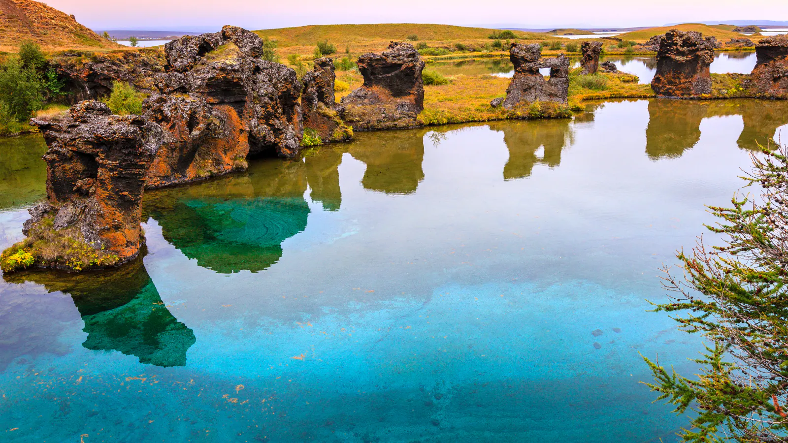
Lake Mývatn Geology
Lake Mývatn is Iceland’s 4th largest lake, with an area of 36.5 km² (14.1 miles²) - yet it’s surprisingly shallow, with a maximum depth of 4.5 m (14 ft). Fed by underground springs, the lake drains into the river Láxá í Mývatnssveit, renowned as one of the finest Brown trout rivers in the world. The abundance of other fauna, such as Arctic char, and the many breeding duck species, including the Tufted Duck and Wigeon, make the area famous among wildlife fanatics and birdwatchers alike.
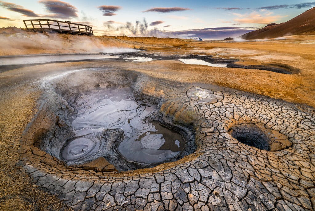
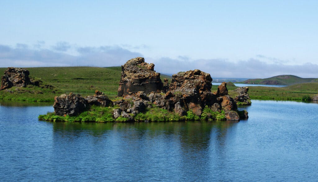
Amazing geological formations and a huge variety of landscapes can be found around the lake’s edge, shaped by the area’s famous volcanic activity. Between 1975 and 1984, the region experienced a series of 9 eruptions, and continental drift was measured at 4.8 m (15.7 ft) as a result. You’ll find many attractions nearby that depict just how volcanic Iceland can be. For example, Hverarönd, which is constantly bubbling and steaming, is an amazing place to visit.
Weather in Lake Mývatn
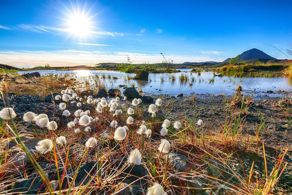
This area is one of the coldest places in the country during winter, with lows of around -9°C, but it also boasts fantastic summers, when daytime temperatures can reach highs of 10-13°C. Clear skies, long daylight hours, and relatively low precipitation make summer the ideal time to explore the dramatic hiking trails and lava fields. In contrast, snow-covered landscapes in winter make for a stark and beautiful experience, providing the ideal opportunity to spot the Northern Lights.
For those visiting in summer, you should be prepared for the swarms of midges - tiny, harmless insects that can descend in large numbers. While they don’t stay for long, they can make certain areas quite unpleasant. They should disappear within a few minutes, but wearing glasses and covering your mouth will make the experience more comfortable while enjoying nearby natural wonders. Make sure you carry insect repellent (apparently, the electronic ones work like a charm) and something to take care of those irritating little bites if you do get bitten.
Where to Stay Near Lake Mývatn
There are three campsites located directly by the lake (see map above) and a few hotels too. Hlíð Camping is the only campsite open all year round. Bjarg campsite lies by the water, offering fantastic views over the lake. Staying lakeside means you’ll have a wide range of great places to visit just a short drive away.
If these sites are fully booked, there are several locations slightly further from the lake’s shores. You can also choose to stay in Ásbyrgi or Vesturdalur, incredible places to both visit and stay in. Most campsites offer the essential amenities you need, like showers, though Vesturdalur provides only restrooms.
In the small village of Reykjahlíð, you’ll find a supermarket, a gas station, a post office, and even a restaurant. If you’d like to sample a pizza, head to nearby Vogar, the village south of Reykjahlíð.
Things To Do Near Lake Mývatn
There are countless things to do in and around Lake Mývatn, but here are a few highlights you won’t want to miss during your visit.
- Hike up the 524 m (1,719 ft) high mountain Vindbelgur and enjoy the tremendous views.
- Enjoy a leisurely drive or cycle around the lake. You can rent a bike from Reykjahlíð. It’s about 38 km (23.6 mi) around the lake.
- Taste the traditional dish Hverabrauð, a very dark bread baked in geothermal heat. Delicious with smoked fish.
- Visit Sigurgeir´s Bird Museum.
- Enjoy a sightseeing flight from the local airport in Reykjahlíð.
- Hike on the numerous trails found in the vicinity and beyond.
Unfortunately, fishing in the river fed by Lake Mývatn is not an option for everyone, despite it being one of the best Brown trout rivers in the world. You need to order your license the year before, but the chances of receiving one are very slim unless you are a member of the fishing club owning the rights.
When you are driving around in these areas, make sure you park properly when you want to take pictures. There are other cars around, and you might put them in jeopardy by stopping in the middle of the road. Going north from the Ring Road might mean rough terrain at times, so make sure to drive carefully when on Icelandic roads. The roads to and around the lake are well maintained, even in winter, but it is always wise to check out Road.is before heading off to ensure conditions are safe.
Nearby Attractions
If you are planning on spending a lot of time in the area, you might want to diversify the types of natural attractions you visit. Here are a few locations well worth adding to any road trip, helping you to get a real taste of all the elements of Iceland’s wilderness.
- Hverfjall Crater - also known as Hverfell, this tephra cone or tuff ring volcano erupted approximately 2,500 years ago.
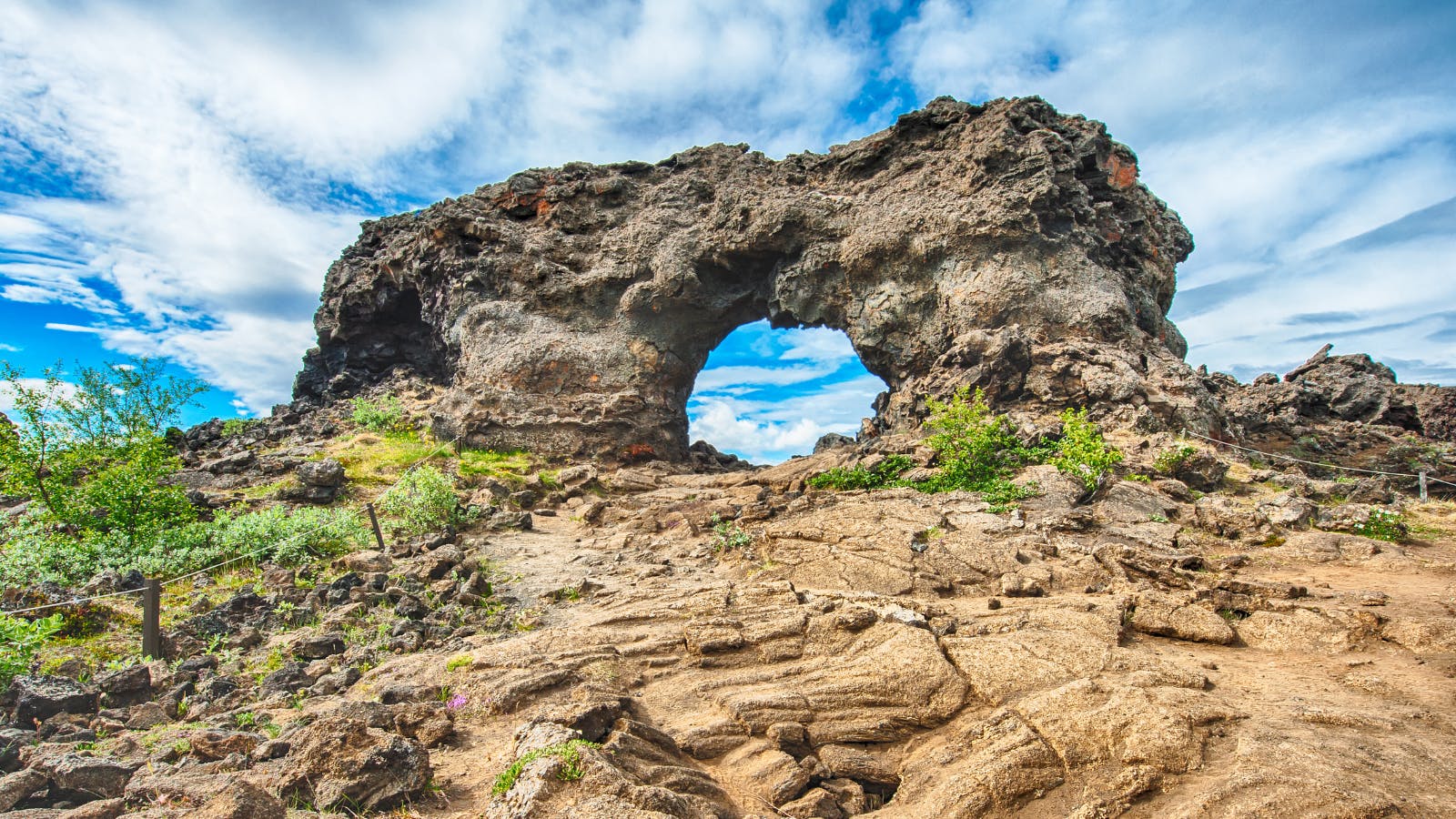
- Dimmuborgir Rock Formations - a vast lava field featuring collapsed lava tubes and surreal volcanic formations, estimated to be around 2,300 years old.
- Námaskarð & Hverir Geothermal Area - a surreal area with bubbling mud pools and sizzling steam vents. Beware, the smell of sulfur lies thick over the area.
- Viti Crater - Meaning “hell” in Icelandic, this 300 m (985 ft) crater was violently formed during a volcanic explosion in 1724.
- Dettifoss Waterfall - Dettifoss is the most powerful waterfall in Europe, known for its immense cascade.
- Hljóðaklettar Rock Formations - Known as the “Echo Rocks”, this area is full of the most bizarre and amazing lava formations.
- Goðafoss Waterfall - Approximately 12 m (39.4 ft) high and 30 m (98.5 ft) wide, this waterfall is fed by the river Skjálfandafljót and is rich in history.
A trip to Lake Mývatn makes it well worth renting a car in Iceland. You can head straight there from the airport, or spend a day or two exploring the capital city before taking your onward journey. We guarantee you won’t be short of things to do - in fact, you might even need to come back! Find your perfect rental car with us today.
Lake Mývatn FAQs
To help you prepare for your visit, we’ve compiled answers to some of the most common questions visitors have about this unique and captivating location.
Where is Lake Mývatn Located?
Lake Mývatn is located in North Iceland, roughly 90 km (56 miles) east of Akureyri. The region lies within a highly active geothermal zone near the Krafla volcanic system. Its position, close to the Ring Road, makes it easily accessible by car.
What is Lake Mývatn Famous For?
Lake Mývatn is a truly special area famous for its diverse birdlife, unique volcanic landscapes, geothermal activity, and unusual formations like lava fields and hot springs. This captivating combination of nature and raw beauty makes it one of Iceland’s most unforgettable destinations.
Why is Lake Mývatn Known as Midge Lake?
The name Lake Mývatn literally translates to “Midge Lake”; this is due to the non-biting midges that commonly swarm the area in late spring and summer months. These insects, while harmless, play a vital role in the area's delicate ecosystem and signal the lake’s rich biodiversity. Travelers visiting during the warmer months are advised to bring repellent and nets.
Can You Swim in Lake Mývatn?
It is not generally recommended to swim in Lake Mývatn due to the delicate ecology and safety concerns. The geothermal activity can result in hot spots in the lake, making temperatures unpredictable. If you wish to swim in the area, it is much safer to head to the Mývatn Nature Baths.
Is Lake Mývatn Good for Birdwatching?
Lake Mývatn is one of the top locations for birdwatching in Iceland, perhaps even in Europe! The rich wetlands and shallow water here provide a precious habitat to more than 13 duck species that nest here, including the Greater Scaup and the Barrow’s Goldeneye.
Safe Travels! #GoIceland